A mosaic map found on the floor of a 6th-century Byzantine church in Jordan offers a useful and unusual guide to the Old City of Jerusalem.
It might seem odd at first that this tourism tip highlights a mosaic floor in Madaba, Jordan – but bear with us. A link to the colorful mosaic can be found here. Enlarge it and follow along. And a modern map of today’s Old City could be helpful for orientation and comparison.
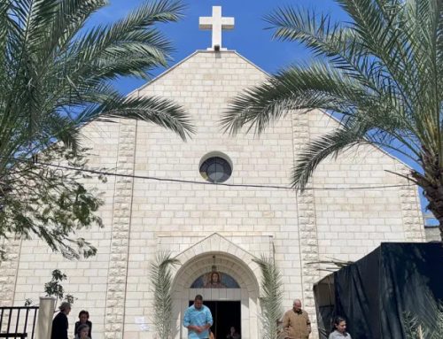
This huge mosaic map once carpeted the floor of a 6th-century Byzantine church, built in Madaba at the height of the Eastern (Christianized) Roman Empire. Today, the map adorns the interior of the Greek Orthodox church of St. George, built on the same spot at the end of the 19th century.
The mosaic depicts the entire Holy Land, though several geographical areas have not survived, leaving large gaps in the map. Towns are indicated by small towers, a boon for scholars who knew of some of them from contemporary writings, but never knew their location. Jerusalem commands a central place on the mosaic, completely out of proportion to the scale of the map, but entirely in proportion to its historical and spiritual significance. The detail of the Holy City is remarkable, down to the level of identifiable structures.
The “orientation” of the map is east, as the word itself indicates; that is, the top of the map is east and north is to the left. (Rotate your modern map a quarter-turn counter-clockwise to correspond to the ancient orientation.)
The city of the 6th century was an expansion of the Aelia Capitolina, as it was rebuilt and renamed by pagan Rome 400 years earlier. The artist’s perspective and sense of proportion is quirky, to say the least, but we can still tour today’s Old City according to his masterpiece.
Let’s start with the gates and streets.
On the left end of the map – the north – was the largest and most vital gate of the city, corresponding to the Damascus Gate of today. Inside it was an oval plaza, uncovered in excavations in the 1970s, along with a Roman tower. Today they can be explored (for a small fee) to the left and below the current gate. The tall column on the plaza was once topped by the statue of an emperor (maybe Hadrian?), which was removed in the 4th century when Christianity became the imperial religion.
The Arabic name of the gate, Bab el-Amud (the Gate of the Column), indicates that the column was still standing in the 7th century when the conquering Arab armies came to town. The column was apparently the central point from which distances in the land were measured. A milestone on the Beit Guvrin road, just south of the Elah Valley, notes that you are now 24 From the plaza, two streets cross the city from north to south. The more easterly one (closer to the top of the map) corresponds to El-Wad Street of today, curving down the “wadi” from the Damascus Gate to the Western Wall. The other is the Cardo (Maximus). One of the columns of its colonnade can be seen in the little Catholic chapel at Station VII on the Via Dolorosa; but far more familiar is the line of restored columns, paving stones and a sidewalk that slice through the Jewish Quarter. The easterly gate, now known as Lions’ Gate or St. Stephen’s Gate, connects to El-Wad Street by means of an east-west street (the beginning of the Via Dolorosa). That thoroughfare appears on the map as far shorter than it ought to be. To the right of it is the Temple Mount, in reality a vast trapezoid covering some 35 acres, but reduced here to an almost inconspicuous strip. Some scholars suggest that the obscurity was deliberate, since the area was considered cursed (“not one stone will be left upon another”) and was abandoned by the Byzantines – witness the fact that when the Muslims arrived, they had to excavate through debris to expose the great rock now capped by the gold dome. The western Jaffa Gate is at the bottom of the mosaic, just right of center. The street that runs east from the gate was the Roman “Decumanus,” which intersected with the Cardo at a “tetrapylon” (four pillars), still visible inside a coffee shop in the Arab market, near the meeting point of David Street and Jewish Quarter Road. An extension from the Decumanus off to the right (south) is today’s Armenian Orthodox Patriarchate Road, which leads to Zion Gate and the Jewish Quarter. That street immediately passes behind two tall towers, each with a window, that were once part of King Herod’s great citadel (today’s Tower of David Museum). One tower is thought to be “Phasael,” the largest of them all and the one that still stands today; the other – which has not survived – was probably “Hippicus,” the second-largest; “Mariamne,” the smallest, had disappeared by the time the map was made. Red-roofed buildings indicate churches, and here are two of the biggest. Exactly half-way along the Cardo is the huge Church of the Anastasis (Resurrection), better known now as the Church of the Holy Sepulcher (tomb). It appears to be upside down, but should be seen as a kind of aerial view. A staircase climbs from the Cardo through a triple doorway to a court of the church believed to be the site of Calvary, and then to the tomb of Jesus under a gold dome. Further south along the Cardo, and abutting it from the opposite side of the street, was another great basilica, the Nea [New] Church. Two of its thresholds, unearthed in the 1970s, are buried beneath the parking lot of the Jewish Quarter; two apses are preserved in a small chamber to this day. Processions apparently took place along the Cardo from the Nea to the Holy Sepulcher. There are other identifiable features on the map, but these are the most familiar ones to Jerusalem’s residents and visitors. By: Mike Rogoff